Get to Know the Area
FALL CREEK FALLS STATE PARK
Spencer, TN
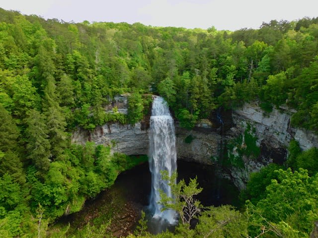
Fall Creek Falls State Park is one of Tennessee’s largest and most visited state parks. The park encompasses more than 29,800 acres sprawled across the eastern top of the rugged Cumberland Plateau. Laced with cascades, gorges, waterfalls, streams and lush stands of virgin hardwood timber, the park beckons those who enjoy nature at her finest. Fall Creek Falls, at 256 feet, is one of the highest waterfalls in the eastern United States. Other waterfalls within the park include Piney Falls, Cane Creek Falls, and Cane Creek Cascades.

ROCK ISLAND STATE PARK
Rock Island, TN
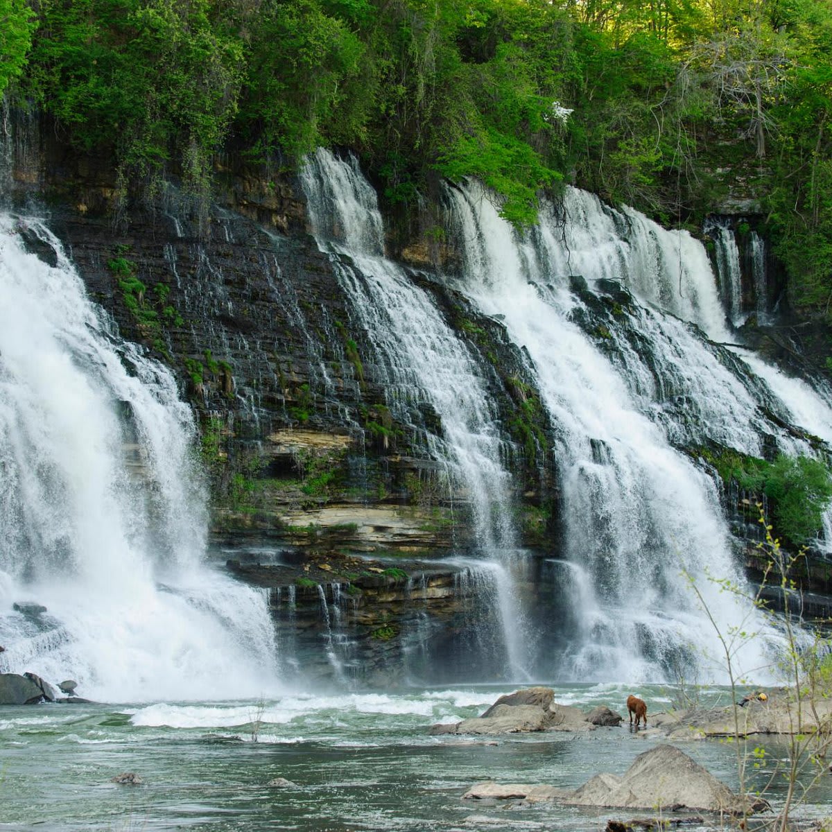
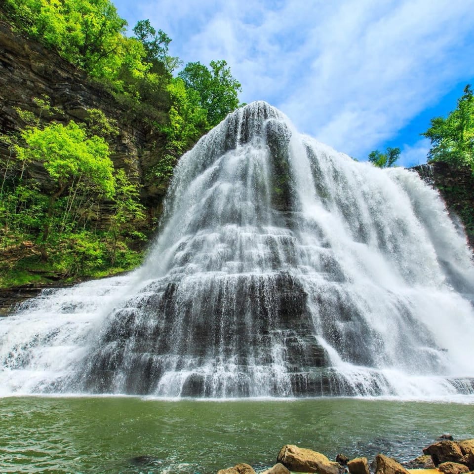
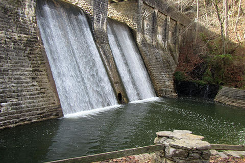
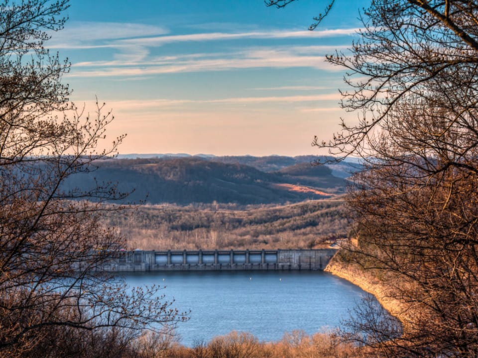
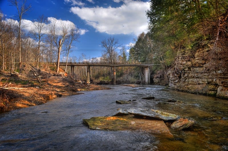
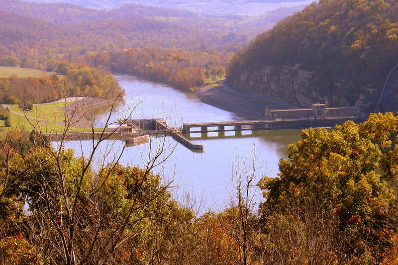
Rock Island State Park is an 883-acre park located on the headwaters of Center Hill Lake at the confluence of the Caney Fork, Collins, and Rocky Rivers. The rugged beauty of the park includes the Caney Fork Gorge below Great Falls Dam. These overlooks are some of the most scenic and significant along the Eastern Highland Rim. Great Falls is a 30-foot horseshoe cascading waterfall, located below the 19th-century cotton textile mill that it powered over 100 years ago. Rock Island became a Tennessee State Park in 1969.

CUMBERLAND MOUNTAIN STATE PARK
Crossville, TN
Cumberland Mountain State Park is situated on the Cumberland Plateau, a segment of the great upland, which extends from western New York to central Alabama. It is said to be the largest timbered plateau in America. Cumberland Mountain State Park began as part of the greater Cumberland Homesteads Project, a New Deal-era initiative by the Resettlement Administration that helped relocate poverty-stricken families on the Cumberland Plateau to small farms centered on what is now the Cumberland Homestead community. This 1,720-acre park was acquired in 1938 to provide a recreational area for some 250 families selected to homestead on the Cumberland Plateau.
BURGESS FALLS STATE PARK
Sparta, TN
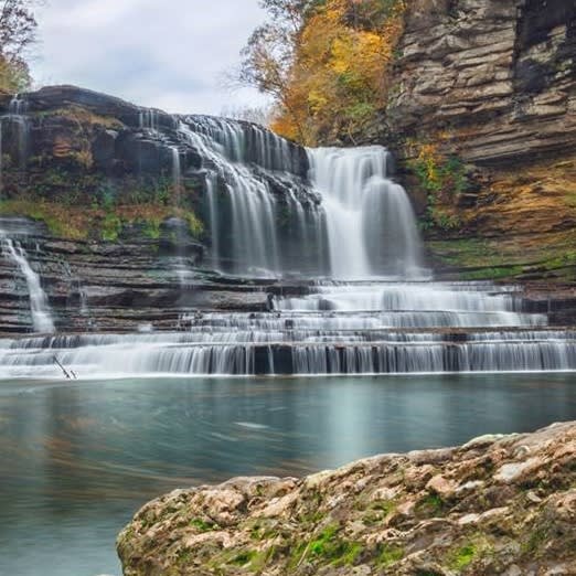
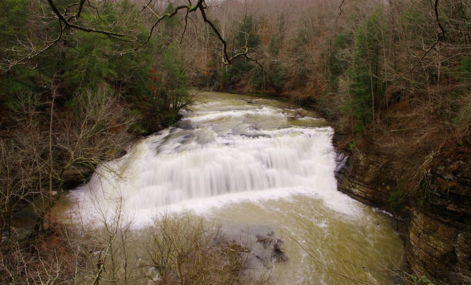
Located on the Falling Water River, this day-use park is noted for its natural beauty and four waterfalls that cascade down from over 250 feet in elevation. The last of these falls is the most spectacular, plunging more than 130 feet into the gorge. The area was originally populated by Native Americans of the Cherokee, Creek and Chickasaw tribes. These tribes used the land as a hunting ground until the late 19th century when a gristmill and sawmill began operating on the river. The Falling Water River was used to generate hydroelectric power for the city of Cookeville from 1928-1944. In 1973, the territory became a designated Tennessee State Natural Area, protecting the diverse forest and aquatic habitats.
CUMMINS FALLS STATE PARK
Cookeville, TN
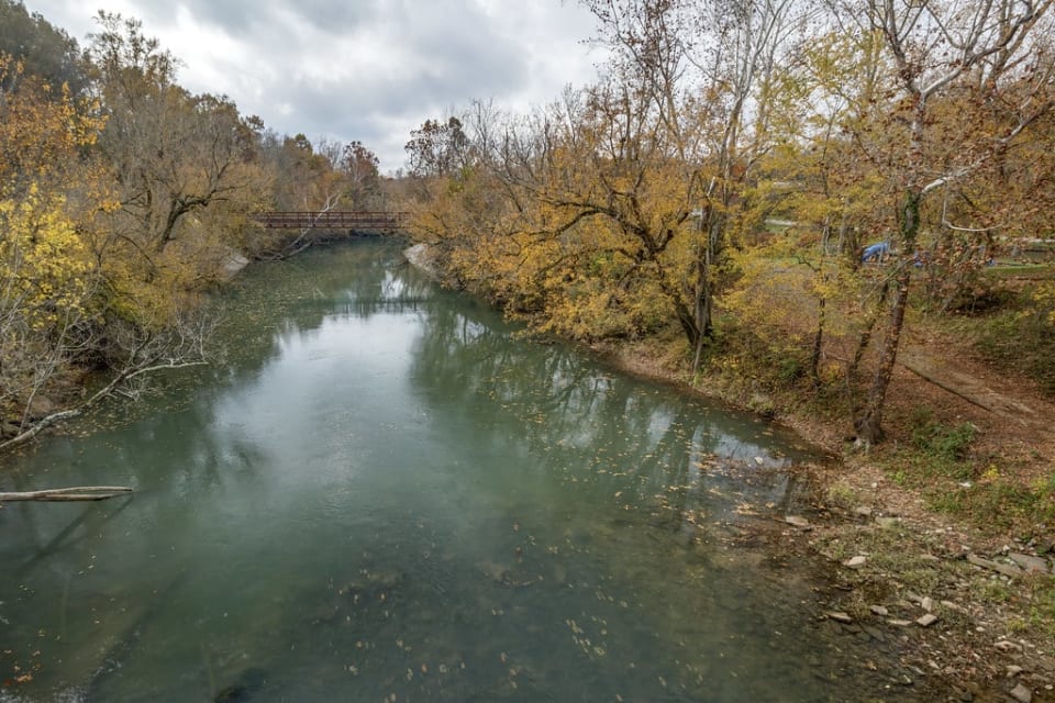
Cummins Falls State Park is an idyllic, but rugged, 306-acre day-use park located nine miles north of Cookeville on the Blackburn Fork State Scenic River on the Eastern Highland Rim. Located in the Cordell Hull Watershed, the area has been a scenic spot and swimming hole for local residents of Jackson and Putnam counties for more than 100 years. Cummins Falls is Tennessee’s eighth largest waterfall in volume of water and is 75 feet high.
STANDING STONE STATE PARK
Hilham, TN
Standing Stone State Park is located in Standing Stone State Forest on the Cumberland Plateau. The park takes its name from the Standing Stone, a 12-foot-tall rock standing upright on a sandstone ledge, which was supposedly used as a boundary line between two Indian nations. When the rock fell, the Indians placed a portion of it upon an improvised monument to preserve it. The stone is still preserved in nearby Monterey, Tenn.
EDGAR EVINS STATE PARK
Silver Point, TN
Edgar Evins State Park is located on the shores of Center Hill Lake in the steep, hilly Eastern Highland Rim. The 6,000-acre park provides many recreational opportunities, cabins, and campsites on one of the most beautiful reservoirs in Tennessee. The park also has a large on-site marina with a restaurant and gift shop.
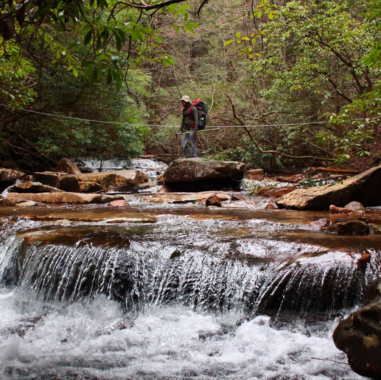
Virgin Falls Trail
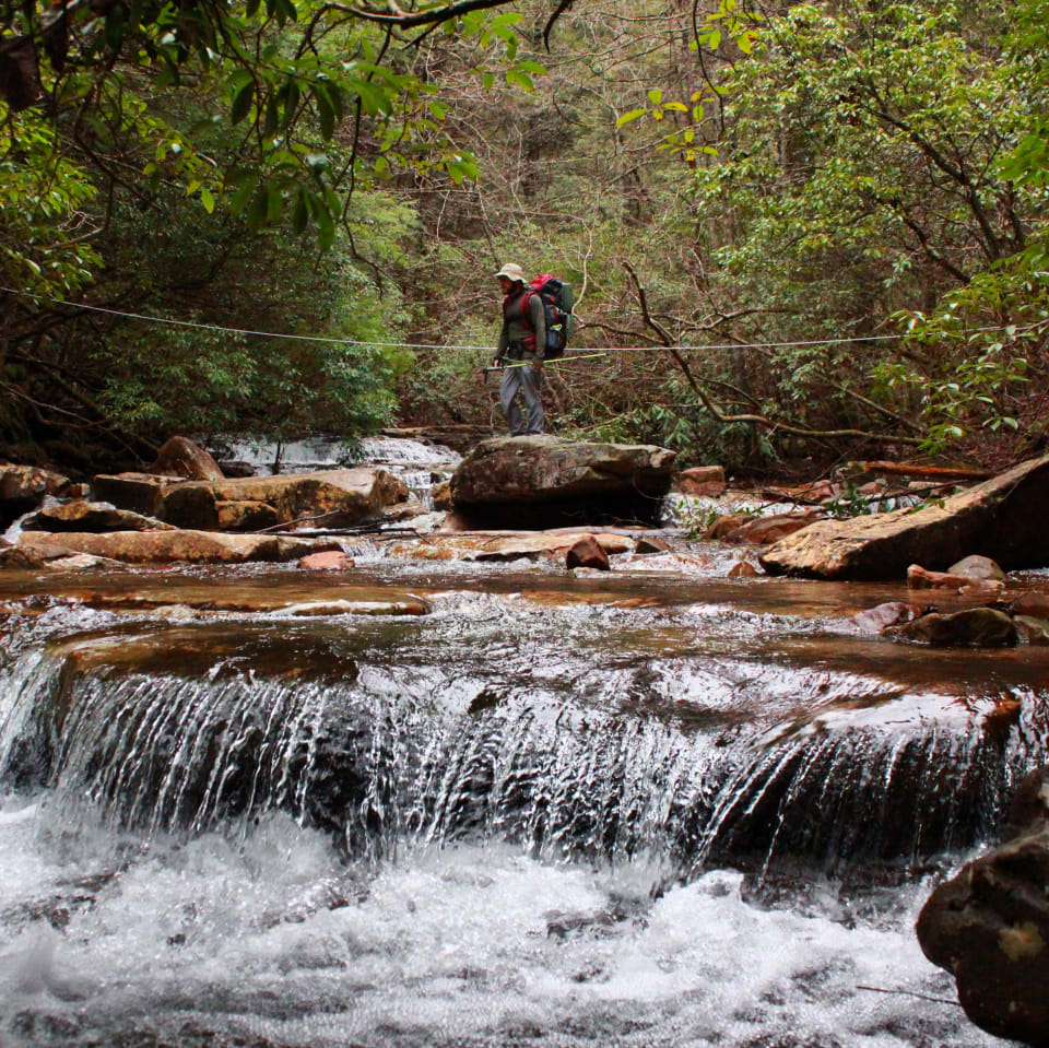
Virgin Falls Pocket Wilderness contains one of the nicest day hikes and short overnight backpacking spots on the entire Cumberland Plateau. Within a 2-hour drive from downtown Chattanooga, this 9-mile hike offers 4 waterfalls, subterranean tributaries, and scenic overlooks. One of the most unusual aspects of the pocket wilderness is its karst features—Virgin Falls being a prime example. Its high-volume tributary bursts out of a cave and flows several hundred feet above ground, before plunging 110 feet. At the base of the falls it immediately disappears back underground. The hike also offers a great cave mouth at Big Laurel Falls, with it's 80 ft ceiling and expansive breadth.
Bee Rock Overlook
For decades, Bee Rock has drawn people from across Tennessee to climb its rocky face or to picnic at the top of the overlook located at the end of a 0.7-mile trail. Many hikers and climbers visited the property while it was still in the private ownership of the Walker family. In December of 2018, Bob Walker donated a conservation easement at Bee Rock to TennGreen Land Conservancy, limiting future construction and timbering on the land, and providing permanent public access to the property. With the conservation easement in place, Mr. Walker generously gave the property to the Town of Monterey for its use as a public park.
Downstream Trail
The Downstream Trail is a 1.6-mile lollipop. It departs from Twin Falls Overlook and continues along the very steep bluff line bordering the river. It features views of the Blue Hole below, Twin Falls, Little Falls, and various seeps, as well as many spring wildflowers & rock formations.
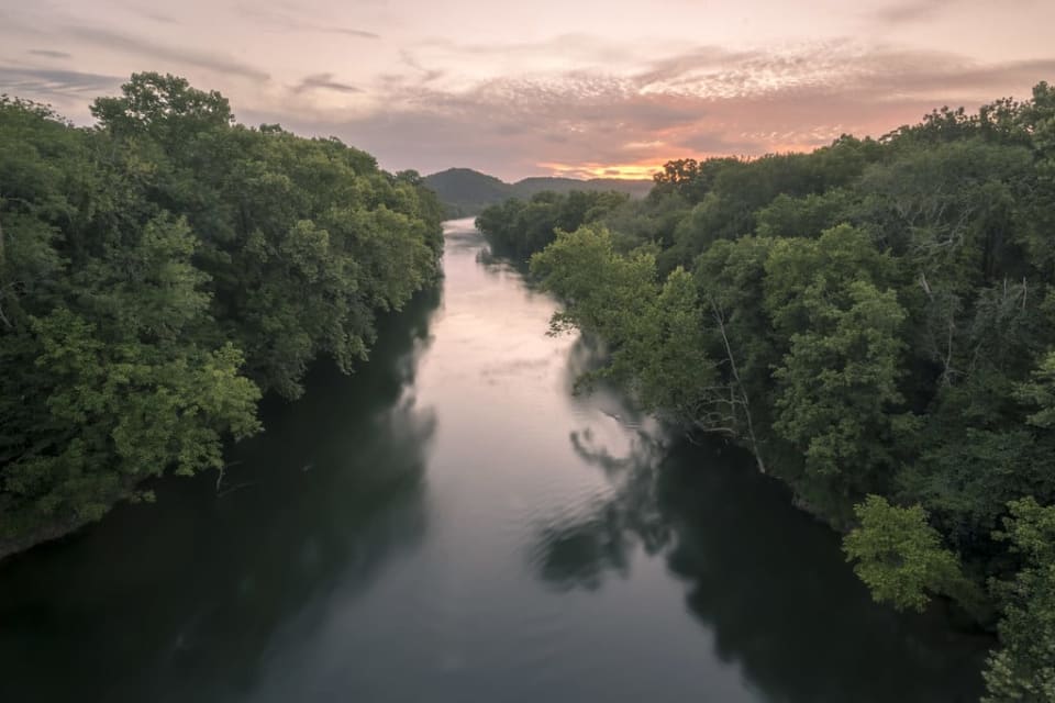
Caney Fork River
The Caney Fork is 143 miles long and like all rivers, it changes its character dramatically from beginning to end. Historically called “The Caney Fork of the Cumberland” it was so named due to the unusually lush stands of river cane along the banks of the lower part of the river where it empties into the Cumberland. As the river descends from its source near Crossville, TN in Cumberland County on the the Cumberland Plateau, it flows at first with a modest descent.
At the historical mining town of Clifty, the river plummets off the plateau and drops 700 feet in elevation within the steepest section of five miles. The river has a series of Class IV and V sections over it’s total 6-7 mile course through the gorge and is popular with paddlers in the spring. This gorge is the centerpiece of an isolated and beautiful wilderness known in whole as Scott’s Gulf, located in White County.
Blackburn Fork Scenic River
Blackburn Fork River is located on the Highland Rim in the Upper Cumberland Plateau. It is a tributary of the Roaring River originating near Cookeville, Tennessee. The rivers most significant geological, scenic and recreational feature is Cummins Falls. It is the eighth largest waterfall in Tennessee and is located within Cummins Falls State Park. The park provides a ½ mile hiking trail to the overlook and a 1.6 mile trail to the popular swimming hole at the base of the falls. Smallmouth Bass are a favorite catch for anglers who wade the river or fish from rocky banks.
Roaring River Scenic River
The Roaring River originates on the Highland Rim near Livingston, Tennessee and flows 37.7 miles to the confluence of Cordell Hull Lake. At the confluence is the U.S. Army Corps of Engineers Roaring River Recreation Area. It offers picnic areas, a campground and boat launch. Further upstream is the Boils Wildlife Management Area so named because at this point the rivers fast moving water runs into slower moving water that is pooled creating the appearance of boiling water. The Boils WMA is a popular paddling destination and wildlife viewing area.
Calfkiller River
The Calfkiller River is a 42.4-mile-long (68.2 km)[3] stream in the east-central portion of Middle Tennessee in the United States. It is a tributary of the Caney Fork, and is part of the Cumberland, Ohio, and Mississippi watersheds. The river is believed to be named for a Cherokee chief who once lived in the area.
Falling Water River
The scenic Falling Water River rises in Welch Hollow just west of Monterey at the edge of the Cumberland Plateau, traversing the Eastern Highland Rim before descending more than 600-feet before exiting the hollow at the southern edge of Buck Mountain into Cookeville's City Lake. This ideal floating and fishing river runs its course, creating the Putnam/White County border and emptying into Center Hill Lake along the Caney Fork. The river is noted for flowing over a series of three waterfalls, culminating in the 136-foot Burgess Falls, as it drops from the Highland Rim to the Nashville Basin.
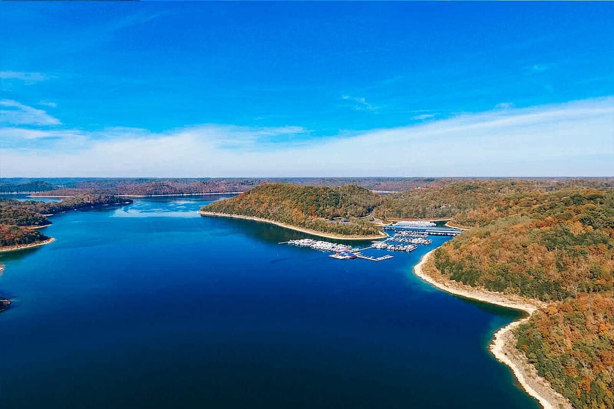
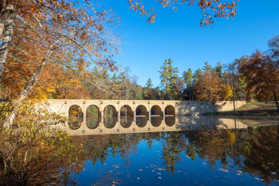
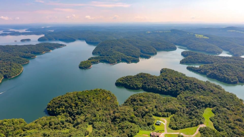
Center Hill Lake
Center Hill Lake is an 18,220 acre lake that features 255 miles of shoreline. The lake was created by the construction of a dam across the Caney Fork River. The U.S. Army Corps of Engineers began construction in 1942 and completed construction in 1948. The lake is located near Smithville, Tennessee which is about an hour drive east of Nashville, TN.
Center Hill Lake offers a wide range of activities for water and outdoor enthusiasts. Recreational activities at Center Hill Lake include, boating, camping, fishing, picnicking, wildlife watching, scuba diving, swimming, sailing, wakeboarding, jet skiing, water skiing, hiking and biking.
The lake is also home to numerous marinas. The Center Hill Lake Marinas offer all the essentials needed for a great day on the lake. Amenities include boat launch ramps, boat storage, trailer storage, fuel docks, fishing bait, fishing license, tackle shops, boat registration renewal, overnight boat slips, and boating supplies.

Dale Hollow Lake
Dale Hollow offers more than just fun on the water — its rolling hills and 620 miles of undeveloped shoreline, combined with a mild climate and long recreation season, make it an ideal family vacation destination. Considered one of the cleanest lakes in the United States, Dale Hollow Lake attracts millions of visitors per year and offers a great variety of water activities, including fishing tournaments, house-boating, boating, floating, skiing, kayaking and much more. The area that surrounds Dale Hollow is lined with terrific trails for hiking, biking and horseback trail riding; great grounds for hunting, camping and bird watching; and terrific sites for sporting, including a world-class golf course.
Cordell Hull Lake
Cordell Hull Lake is a reservoir managed by the U.S. Army Corps of Engineers. The U.S. Army Corps of Engineers is known for their quality in outdoor recreational opportunities. Cordell Hull Lake offers numerous outdoor recreation activiteis including camping, boating, fishing, picnicing, hiking trails, bike trails, horse trails, and wildlife viewing. Come and enjoy two of our top rated campgrounds, which are Defeated Creek Campground and Salt Lick Creek Campground. Also, they offer three day-use areas with swim beaches, picnic sites, and play grounds, which are Defeated Creek Day-Use area, Wartrace Creek Day-Use area, and Roaring River Day-Use area.
- Piney Creek Falls drops 40 feet into Cane Creek Gorge.
- Cane Creek Falls is an 85-foot drop into Cane Creek.
- Rockhouse Creek Falls is across the gorge from Cane Creek Falls and drops 125 feet.
- Cane Creek Cascades flows 45 feet down a 60-foot wide sandstone wall behind the park's Nature Center.
Wildcat Falls drops 35 feet and can be seen from your car as you travel Hwy. 70E, five miles east of Sparta. Drive half a mile farther east and you can view scenic Sunset Rock, with its 50-mile view of the Central Basin of the Cumberland Plateau. As the name of the monument suggests, the best view is at sunset.